Tuesday, February 21, 2012

Traffic machine vs. Human machine

I took a walk down to Oslo's ever-developing neighborhood of Bjørvika the other day - primarily to get some pictures of the de-constructing of the Bispelokket "trafikkmaskin." Literally called a "traffic machine" in Norwegian, it was a series of stacked rotaries that handled the highway seeking traffic along the Oslo fjord over the last 40 to 50 years. Not unlike the Big Dig project in Boston, this raised construction has been replaced with a traffic tunnel, so its demolition has been planned as a part of this new neighborhood development that is meant to connect the Opera district with the rest of the city.

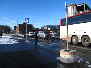
The pedestrian and automobile routes to, around, and from this current construction site continues to perplex Oslo residents. People are rerouted on a daily basis, with a variety of signage that describes the circuitous at best detours. I found myself somewhat amused at the physical effort currently required of a pedestrian to make a simple loop around the new neighborhood. It all began with the need to cross a road, which is no longer just a road but a multi-lane rotary.


And then the solution for it..

The ramp and bridge to the left crosses the rotary directly to the front.

 It seems that we've gone from ramping cars out of the way overhead in the traffic machine, to this solution I am naming the human machine - ramping pedestrians up and over traffic. Of course the resulting view gives an interesting perspective on the otherwise un-crossable road.


Eventually on the other side I came to the site of the old Bispelokket - where not much of it is still intact.


Behind the Opera this and other construction has taken over for the time being. Pedestrians who are typically put first on Norwegian roadways are channeled between concrete barriers and reminded to watch for turning traffic. 

The sign here says "Careful! Does the car see you?"

Traffic to be crossed between the Opera plaza and the next pedestrian bridge.


View over old Bispelokket site from Opera's pedestrian bridge.

These aspects of planning and engineering the movement of traffic and humans in machines brings the 1920s German movie Metropolis to mind. There is something particular dystopian about development, especially while it is underway. It is difficult to look at this site today and imagine that in the future it is to be a progressive pedestrian friendly neighborhood that will magically connect the new buildings along the fjord to the existing urban fabric behind the train tracks. 


The plaza in front of the Opera currently stands as a pedestrian friendly island amidst chaos.

More photos from this site here.


Wednesday, February 15, 2012

'How should Oslo be?'

Last night at Oslo's center for design and architecture (DogA) opened an exhibition on the conceptual and actual planning for the future growth of the city. The day before, a news article covered one set of concept projects by MVRDV plus some local offices, which were meant largely designed to provoke. As seems to be the trend in urban planning, the questions are very clear but the solutions less so.

MVRDV image from Aftenposten, ring of high rises around city center.
Source: http://ap.mnocdn.no/incoming/article6759467.ece/ALTERNATES/w780c169/FS00015036.jpg?updated=110220121826

I was struck first by the article with MVRDVs proposals. They cleverly cover a great deal of the city and surrounding districts with variations of feasibility. Many of the options suggest densifying and/or developing national landmarked parks and other points of interest which has made for intriguing local debates. In the end, I cannot help feeling a bit underwhelmed by the work. Somehow it seems that the richest country on the planet with some of the most progressive environmental policies might be able to push for something new. These published "solutions" instead transport me directly back my undergrad education flipping through Koolhaas' 1998 book S, M, L, XL. Then the forms, graphics, and principles seemed new and innovative, but I cannot identify any points of departure from urbanism in the late 90s and that of today - nearly 15 years later.

Other proposals held a great deal of emphasis on the development of infrastructure and the creation of small villages in the areas around Oslo. While I appreciate that these villages took an amount of density, services and public transportation into account, I am not sure that they will lead to anything different from American sprawl.

I cannot help but notice many missed opportunities already existing in Oslo proper which may or may never be addressed. Some friends of mine live near the forest border in the north. Their neighborhood is served by several public bus lines - it is less than a 20 minute ride to the city center, a 5 minute walk to the forest trails, but it is nearly 15 minutes walk to the nearest grocery store. There are many preschools, some sports fields, but not a single cafe or restaurant. The address is Oslo, but the lifestyle quickly becomes that of a suburb - cars seem more useful than the buses and both vehicles in mass compete dangerously with bicyclists, skaters, and joggers along the one major traffic route that has never held a sidewalk.

The new village development plans shown in the exhibition hope to address such concerns for new neighborhoods, but what will happen to the current ones? Rather than maps of transportation corridors and ring roads and walking distance to train stations, I think it might be a good time to think about a different scale. It would likely paint an amazingly unsustainable picture if we looked at Oslo from the current location of other services to population density. How far must people commute to work, yes, but also how far must people commute to the grocery store? If we want to densify Oslo, part of the solution should be including all the services that draw people to, and support them within, a place. Allow and encourage the elements that draw people to new developments in the existing ones - if we can make more people want to live in existing neighborhoods then density will come on its own. In my opinion it would promote healthier growth to add a post office, cafe, and market to an existing residential neighborhood and let the next farm over contribute to the food supply instead of the residential footprint of the city.