I've been reading Paul Shepard, "Where We Belong", and wanted to share some of his thoughts that I found striking. There has been a building aggression in my mind, the more I hear about recycled content and sustainable materials, and building - when the obvious contradiction that no one seems to admit is that the most sustainable building practice is to not build at all. To make his point, the words are strong and ideas provocative, even if disturbingly so. I find myself wondering why sustainability has taken the market driven course it has when there were scholars publishing such words as early as the 1960s..
"If you must have some symbolic actions, I recommend the following: throw your wrappers, papers, butts anywhere, beer cans in the streets, bottles on the berms and terraces; uproot and cut down all ornamental trees and replace them with native fruit-bearing trees and bushes; sabotage all watering systems on all lawns everywhere; pile leaves, manure, and garbage among growing things; return used oil, tires, mattresses, bedsprings, machines, appliances, boxes, foil, plastic containers, rubber goods, and all other debris to their origins - seller or manufacturer, whichever is easier - and dump them there; unwrap packages in the place of purchase and leave the wrappings.
When this has gone on long enough, some tokens of the glut of overconsumption will at least be evident. Equally important, there will be less refuge from the countryside with its regimented monocultures, scalped slopes, poisoned rivers, and degraded rangelands. Our society goes for letting it all hang out, so let's do it. Are encounter groups in? Let's raise the encounter a whole octave and confront the real human ecosystem that we live in. Some great Avon lady keeps rouge on the cheeks of the middle-class neighborhood, the industrial park, and the college campus; the same tinsel earth mother in whose name the slaughterhouse is hidden, the zoo's dead are unobtrusively replaced, and the human dead are pseudo-fossilized." (Shepard, 'Ugly is Better')
Granted, any "civilized" place would never act by these measures, but a point still stands.. If we all had to live in the refuse which we produce, perhaps everyone would be forced to second think their habits?
Saturday, May 16, 2009


Tuesday, May 12, 2009
Infrastructure of Scale - World
Having spent a reasonable amount of time looking around me and focusing on the day to day, even micro-scale - I decided to back up for just a bit.. A lot of aspects of my life and observation are changing, slowly the day to day perspective in my mind, and soon the day to day physical surroundings. I have began reading Paul Shepard while reflecting on my upcoming move - Norway. It seems only fair to dwell for a second on the global scale at the very most basic and historic infrastructure existing - Geology. Beneath everything that we have ever built or dreamt of building are often overlooked layers of soil and rock - land formations with specific identities and traits that have existed long before us..

Roughly, this is the path I will be taking later this summer. At this scale it appears manageable enough, but scrolling north and east on Google maps between New York, NY and Trondheim, Norway shows it to be an impressive distance, a bit over 3600 miles to be more precise. The change in latitude is most striking when comparing relative location to Italy or Ireland.
As Google's aerial views are taken in winter, the differences between these places stand out even moreso. The following shots are of the areas around New York and Trondheim taken at the same scale:
 Long Island really is quite large for the record. The area is impressively flat when it comes down to it.
 Norway is dark in the winter. From what I've read, the Trondheim area experiences approximately 3 months of 3-5 hours of daylight or less each year. Zoom into the city of Trondheim in Google and it's covered both in patches of snow and a consistent gray mist, also typical for the Scandinavian countries. The topography is intense - a mountain range runs along the right edge of this image, while the country slowly opens up to Atlantic Ocean further west.
New York and Trondheim are both somewhat coastal, but with various layers of protection from open sea. Beyond this, I expect that both the geologic and climatic differences will be great. As daunting as Norway's winter may be, I continue to believe that it sets up great groundwork for research. How do people live in these conditions, and exactly what infrastructure (on a local scale) is necessary to deal with such an agressive natural infrastructure dealt to this country over the past millions of years on the global scale?

Roughly, this is the path I will be taking later this summer. At this scale it appears manageable enough, but scrolling north and east on Google maps between New York, NY and Trondheim, Norway shows it to be an impressive distance, a bit over 3600 miles to be more precise. The change in latitude is most striking when comparing relative location to Italy or Ireland.
As Google's aerial views are taken in winter, the differences between these places stand out even moreso. The following shots are of the areas around New York and Trondheim taken at the same scale:
 Long Island really is quite large for the record. The area is impressively flat when it comes down to it.
 Norway is dark in the winter. From what I've read, the Trondheim area experiences approximately 3 months of 3-5 hours of daylight or less each year. Zoom into the city of Trondheim in Google and it's covered both in patches of snow and a consistent gray mist, also typical for the Scandinavian countries. The topography is intense - a mountain range runs along the right edge of this image, while the country slowly opens up to Atlantic Ocean further west.
New York and Trondheim are both somewhat coastal, but with various layers of protection from open sea. Beyond this, I expect that both the geologic and climatic differences will be great. As daunting as Norway's winter may be, I continue to believe that it sets up great groundwork for research. How do people live in these conditions, and exactly what infrastructure (on a local scale) is necessary to deal with such an agressive natural infrastructure dealt to this country over the past millions of years on the global scale?
Monday, April 13, 2009
This is Brooklyn - 2

Back to the eastern DUMBO Buddhist Temple mentioned earlier. This might be my favorite example of adaptive re-use, particularly in New York. What used to be a gas station is now a festive - if meek - Buddhist worship center. The CMU - walled-in site encloses a space that triples in function, from entry courtyard to small parking lot, to basketball court and play area.


On the day I was there, a well respected Bodhisattva was visiting from Asia to perform ceremonies that afternoon. Our tour guide explained that what looks like tattered flags one might see at a used car lot are actually a part of the tradition. They are prayer flags, hung in strands newly for special occasions and buddhist tradition prohibits them from being taken down. Over time, the old flags wear, and new flags are added. As breezes blow through the flags, it is said that the prayers from the center are sent out into the world...

A truly poetic concept, particularly with such a vibrant cultural center being located in such a dreary post-industrial area of the city.
Sunday, April 5, 2009
This is Brooklyn - 1
A walking tour through Vinegar Hill and the Brooklyn Navy Yards, just east of DUMBO shows some unexpected realities existing in Brooklyn.

Typical DUMBO - ever present new development (or halted new development in this case) over the old.

 There is a Buddhist center in a most unsuspecting spot (more on this later).
 Preserved (and now historically landmarked) brownstones.. few and far between.

The rest of the landmarked district (the only working class district to be landmarked in NYC) - a 1850s-1940s business district is now fully residential - living rooms function behind shaded storefronts.


Most unbelievable for the area, one particularly fortunate family lives in a mansion - the old Navy Commandants' home which is now private property. 28 rooms on 4 acres of land purchased in the early 90s for just $2 million. This is at the crest of Vinegar Hill, maybe 1/2 mile from the waterfront, with a view to lower Manhattan.
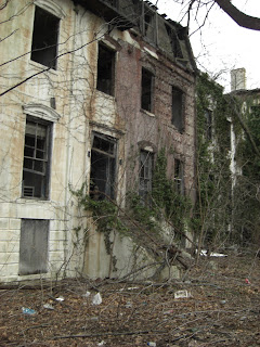
The other side of the Navy Yards show an easily missed hot debate topic in the preservation world. 10 + historic buildings formerly owned by the US Navy await their fates as developers consider their demolition for the purpose of providing a supermarket with a 350 car parking lot. The Municipal Arts Society is fighting for their restoration and rehabilitation.


 These plastic flowers have been placed with care in the midst of the chaos of overgrowth, which has a powerful aesthetic all of it's own.

Typical DUMBO - ever present new development (or halted new development in this case) over the old.

 There is a Buddhist center in a most unsuspecting spot (more on this later).
 Preserved (and now historically landmarked) brownstones.. few and far between.
The rest of the landmarked district (the only working class district to be landmarked in NYC) - a 1850s-1940s business district is now fully residential - living rooms function behind shaded storefronts.


Most unbelievable for the area, one particularly fortunate family lives in a mansion - the old Navy Commandants' home which is now private property. 28 rooms on 4 acres of land purchased in the early 90s for just $2 million. This is at the crest of Vinegar Hill, maybe 1/2 mile from the waterfront, with a view to lower Manhattan.
The other side of the Navy Yards show an easily missed hot debate topic in the preservation world. 10 + historic buildings formerly owned by the US Navy await their fates as developers consider their demolition for the purpose of providing a supermarket with a 350 car parking lot. The Municipal Arts Society is fighting for their restoration and rehabilitation.


 These plastic flowers have been placed with care in the midst of the chaos of overgrowth, which has a powerful aesthetic all of it's own.
Thursday, March 26, 2009
The Presidio (and Goldsworthy) - II

The Presidio exhibit related to the Andy Goldsworthy piece related much of the history of the site, along with Goldsworthy's interpretation. The story is quite interesting - more here (http://www.presidio.gov/experiences/spire.htm). To paraphrase, several species of the originally planted trees have been dying for various reasons, including climate, species selection, and soil conditions. Recently, the organization which oversees the Presidio has been planting new batches of trees to replace those dying - a new 2 to 3 acres of trees are planted each year to stagger the age of the growth and maintenance requirements.
Several articles I have read about this project since the trip speak of the "militaristic" alignment of the existing/original trees in the park. Apparently the army chose to plant trees in a grid, and this practice is being continued. From what I witnessed, the 2-3 acres being planted each year seem to follow with large swaths of single species. Given my brief experience in landscape architecture, I find this curious when current practices greatly discourage monocultures. I would like to dig up more information about what ecologists and arborists think about the Presidio from the standpoint of biodiversity. On the other hand, the aesthetic effect of the grids of plantings surrounding Goldsworthy's 'Spire' of matured and fallen trees is a powerful one.


The Presidio (and Goldsworthy) - I
When in San Francisco, I had an objective to get out of the city and into a more natural surrounding. Amidst the rain, I realized that I would likely have to settle for a hike through the Presidio during the few clear hours of my visit. Reinforcing this idea was the news that Andy Goldsworthy had recently installed a 'spire' in the park so I set out to learn more about it.
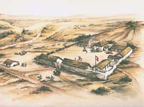
Little did I know before this trip, but the lush seeming Presidio that stands today is a man-made forest. What is more incredible is that the land originally (and not that long ago) consisted of marshy swamps and windblown sand dunes. In 1846, the US Army and eventually the Army Corps of Engineers worked to fill the land in order to build the better known military post and plant what has grown into a forest.

Hiking through the park, the Presidio as it stands today, open to the public, I was impressed to see some passive infrastructures at work. It seemed that hiking through the day after heavy rains was a good time to see the land at work.

Also interesting was spotting the breakdown of some of the enhanced natural systems and human interface of sandbags and piping.

The state of the park varied, particulary during the 'off season' for vegetation in CA. But the quality of the trees, meadows, and the chance to spot some more natural growth still gives a more wild and natural feel than a visitor might expect of a manmade site around 150 years old.


Little did I know before this trip, but the lush seeming Presidio that stands today is a man-made forest. What is more incredible is that the land originally (and not that long ago) consisted of marshy swamps and windblown sand dunes. In 1846, the US Army and eventually the Army Corps of Engineers worked to fill the land in order to build the better known military post and plant what has grown into a forest.
Hiking through the park, the Presidio as it stands today, open to the public, I was impressed to see some passive infrastructures at work. It seemed that hiking through the day after heavy rains was a good time to see the land at work.

Also interesting was spotting the breakdown of some of the enhanced natural systems and human interface of sandbags and piping.

The state of the park varied, particulary during the 'off season' for vegetation in CA. But the quality of the trees, meadows, and the chance to spot some more natural growth still gives a more wild and natural feel than a visitor might expect of a manmade site around 150 years old.


Wednesday, February 25, 2009
San Francisco in the Rain

Not heeding the mild warnings of friends resident to Northern California, I visited San Francisco in the midst of their rainy season. And rain it did, for 4 of the 5 days I was there. However, the break from snowy, icy New York and the attitude of the locals even enjoying the marked change in weather lead me to embrace the season and make what I could of exploring the city. It was interesting to see some pacific dwelling plants in funky hibernation modes which I never experienced on my previous summer visits.

This being my third time in San Francisco, I sought to gain further insight on the city's relationship to nature. Surrounded by water and topographically shaped by strong geological forces, no amount of pavement, concrete, and building mass can deny the natural substrate the city was founded on.


As I have noted before, the long growing season and climate makes lush green spaces possible on every scale. It's great to see how residents individually embrace vegetation allowing both manicured landscapes and wild unmaintained plants to thrive.


Subscribe to:
Posts (Atom)